Area 51 / Groom Lake
37°14′N, 115°48′W
Lincoln County, southern Nevada — detachment of Edwards AFB on the Nevada Test and Training Range
[from the public record]
37.2333, -115.8000 · view on OpenStreetMap →
What's documented
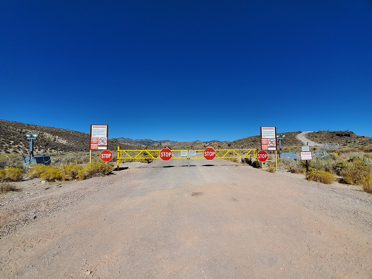
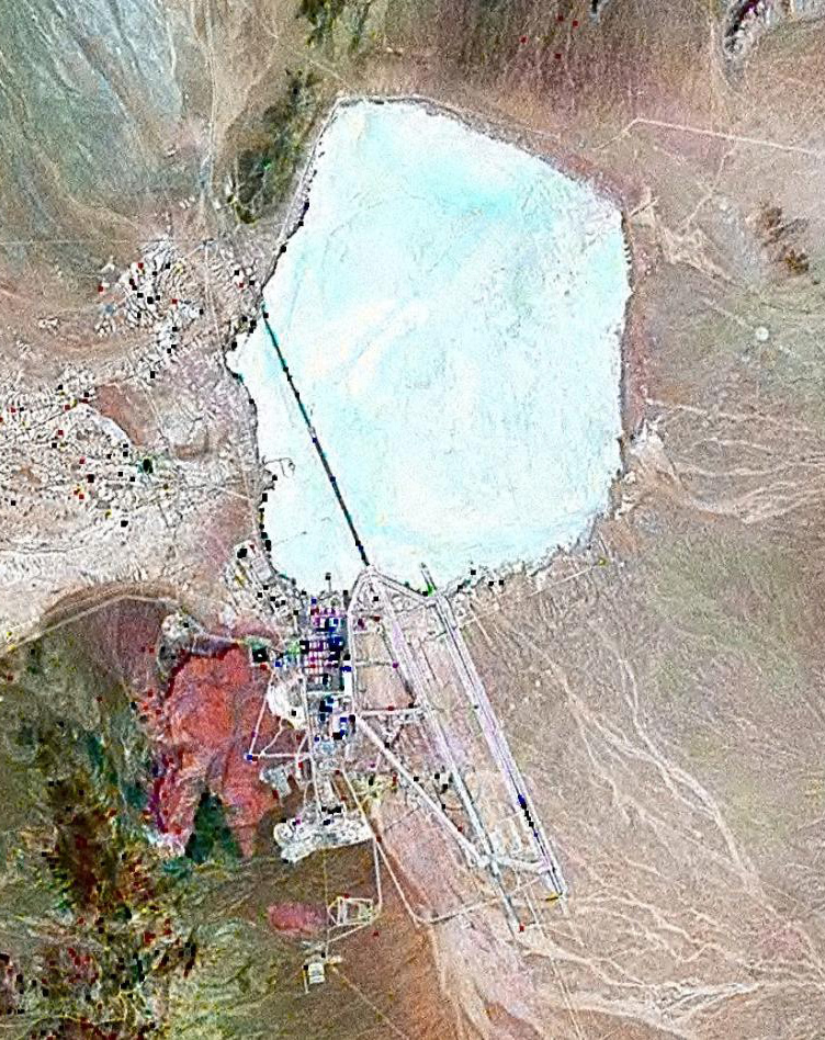
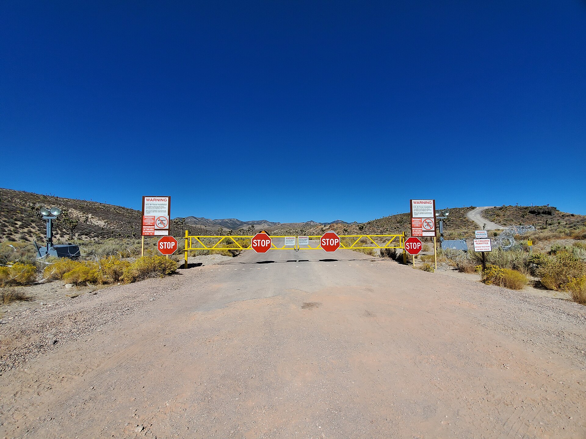
Area 51 is the common name for a U.S. Air Force facility at Groom Lake, a dry lakebed in the Nevada desert. The site has been used since 1955 for the flight-testing of classified aircraft, beginning with the Lockheed U-2. Its existence was first formally acknowledged in declassified CIA documents released to researcher Jeffrey Richelson on 15 August 2013 under a 2005 FOIA request. The surrounding airspace is designated R-4808N and is among the most restricted in the United States.
Notable & intriguing
-
The CIA officially acknowledged Area 51’s existence on 15 August 2013 in a 407-page declassified internal history of the U-2 program, released under a 2005 FOIA request by Jeffrey T. Richelson of the National Security Archive.
CIA, ‘The Central Intelligence Agency and Overhead Reconnaissance: The U-2 and OXCART Programs, 1954–1974’ (declassified 2013)
-
Two Lockheed engineers — Edward Lovick and Kelly Johnson — supervised flight-testing of the A-12 OXCART at Groom Lake beginning 26 April 1962. Cover stories prepared for Nevada residents in case of A-12 crashes existed pre-staged for each test.
CIA OXCART history (declassified 2013)
-
Workers at the facility have been bused in from Las Vegas’s McCarran Airport via the unmarked ‘Janet’ airline (call sign WWW), operating since at least the early 1970s. Flight schedules are publicly visible on flight-tracking websites; destinations are masked.
Edwards AFB Detachment 3 records; flight-tracking via FlightAware/FAA registry
-
In 1994, eight civilian Area 51 workers and the widows of two more filed suit against the EPA, the Air Force, and the Department of Defense alleging illegal open-pit burning of toxic materials at the site. President Clinton signed Presidential Determination 95-45 on 29 September 1995 exempting the facility from environmental-disclosure law.
Frost v. Perry; Presidential Determination 95-45 (29 September 1995)
Public-record items already documented about this subject. Folklore is labelled. Sources cited where the specificity warrants it.
Suggested watching
-
Bob Lazar: Area 51 & Flying Saucers (2018) documentary
Corbell's profile of Lazar thirty years after the 1989 KLAS broadcasts. Mostly a vehicle for Lazar's own account of S-4 and the sport-model craft; minimal independent corroboration is attempted.
watch as Lazar-on-Lazar primary source; do not mistake for adjudication
-
UFOs: The Best Evidence — Government Cover-up (1996) documentary
George Knapp-fronted Showtime production, Knapp's own reconstruction of the Lazar story plus broader Groom Lake context. Knapp interviews former employees on camera.
Knapp is the closest thing the Lazar story has to a careful journalist
-
Area 51: The Alien Interview (1997) documentary
The Victor / 'alien interview' tape that briefly dominated 1997 broadcast television. Almost certainly a hoax; included because the cultural footprint is enormous and the documentary itself is a case study in how UFO media propagates.
the tape is widely judged a hoax; watch as artifact, not evidence
Public-record imagery
Referenced in the codex
- 3. The Observers Above The third layer. The rectangle under the Vostok ice. The same rectangle in two other oceans. The man at Starbucks's "nearby galaxies" claim, taken seriously without being believed.